Day Six: September
19, 2016
Wyoming. We left the A Western Rose motel in Cody and headed
east. Another snappy slogan accompanied
a red, white and buffalo sign in Byron, Wyoming: “A great place to live.”
We saw something that I thought no longer existed. A train passed us that was pulling an actual caboose!
It wasn’t long before we saw a sign with a familiar
name: Pryor Mountain Wild Mustang
Center. I had been to the Pryor
Mountains with the Scott Community College Environmental Club, on our class
trip in June of 2004, where we saw the wild horses in situ. I didn’t realize how close we were to the places I had
visited in Montana that summer.
We didn’t take the time to explore the mountains and look
for the herd—it simply wasn’t feasible with the trailer/transmission situation,
but we did stop at the Center, where I learned that the famous white wild
mustang, Cloud (of PBS documentary fame) is 21 years old now, still alive, but
aging and lost his herd to a younger stallion last summer.
 |
| Apparently not everyone valued the importance of the wild horses. |
Back on the road in this beautiful open country between the
mountains, and soon we see a herd of cattle along the highway and shoulder of
14ALT E with cowboys on horses AND ATVs!
Sadly we were moving too fast to get a picture, but I was amused to see
them using ATVs the same way horses were used.
We passed a sign that read, “Steep grades ahead.” Uh-oh.
Hoping we could make it. Too late
to turn back now, and this is the shortest route back to I-90. A jackrabbit ran across the road in front of
us, reminding us to not be afraid, but to stay alert.
It wasn’t long before the climbing began, coming up out of
the broad “flateau” of the land around Big Horn Lake into the Big Horn
Mountains.
Almost immediately it was
steep! Steep, narrow, no shoulder. For me, terrifying and exhilarating, too. It seems I have an almost pathological fear of
heights. It was a slow, harrowing climb.
I was reassured to see semi-trucks on the road—it made me believe we,
too, could make it over these mountains.
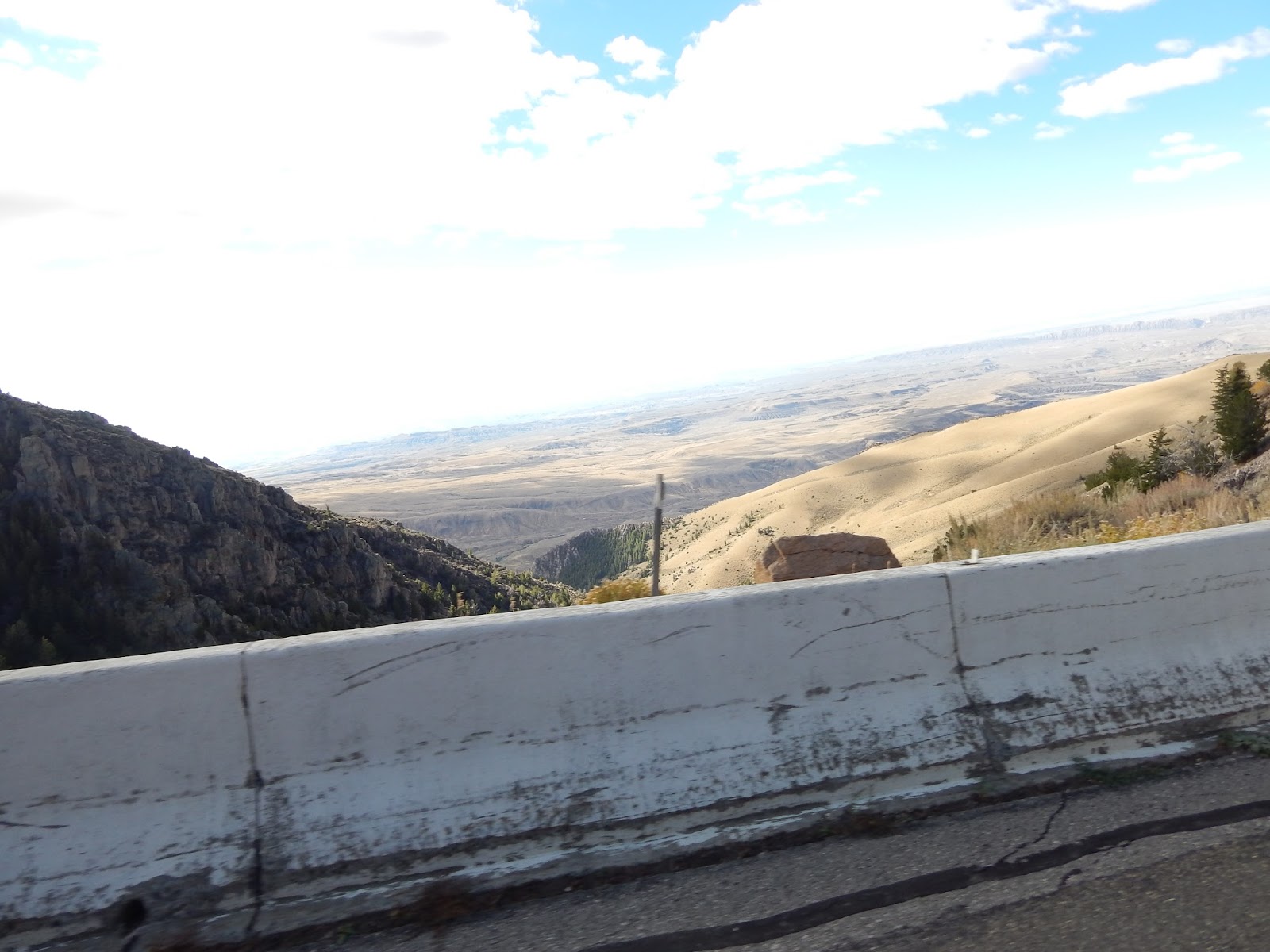
The road is well-engineered as well, with concrete guard rails in most
places, which took the sharpest edges off the fear.
 |
| The Bighorn Mountains loom ahead. |
At every turn, we got a breathtaking view of the valley
below and behind, and the storms over Yellowstone in the distance to the west.
To give the transmission a rest, we stopped at a pullout not far from the great
Medicine Wheel of Wyoming. Spirit directed me to get my magic basket out and do
a ceremony.
In honor of the Medicine Wheel and the First Nations of this
land, I called the in the spirits of the four directions for their support on
the Dakota pipeline protests, and to protect us on our journey. It was a powerful moment, with the wind
blowing and that vast vista before me.
 |
| Panoramic view to the west from the pullout where I held ceremony. |
Thus empowered, we returned to our climb. Following US 14 ALT E, one climbs over 7,000
feet in 11 miles at a 10% grade to a height of just over 10,000 feet. The top is a nice, relatively flat, mesa top,
a relief from the harrowing climb before beginning the equally frightening
descent on the other side.
 |
| On the down side. |
 |
| The view from close to the top. |
 |
| The relatively flat stretch before descending the eastern slope. |
 |
| We can see the valley to the east of these mountains. |
A couple of hours later, we made it back to the Interstate
at Ranchester. By the time we got south of Sheridan, Wyoming, we were in folded velvet hills in hues of green and gold. Veins of creeks and rills support a tiny host of dwarven trees. The land is a rumpled bedspread abandoned by some glacial giant of long ago. Then we emerge into the treelees rolling hills of the northern plains.
Near Powder River, vestigial rocks and upthrustings like rocky thumbs protuberate briefly and are lost again in the barren plateau. Road machines, idle now, stand like mechanical elephants, with trunks raised.
We pass a final little mountain pass and as I glance down into the a cleft between the rocks, I am aware of a creek below. A side road leads down into the little canyon. Soothed by the ceremony and the relief of getting safely down the mountain, and being a bit hypnotized by the rhythm of the highway, I began to experience a shamanic-type vision.
I saw myself going
down the road to the bridge across the creek below. There are trees, of
course, all along the little river. There is a chute and I glide down
the chute. The path levels off, well shaded by the mountains. The
sunlight illuminates the little river before that hosts yellow aspens
and other vegetation in fall colors. I realize there are fairies in the
trees. At first they dart away and become very still as I arrive. Then
they realize it is me and they went on about their business.
I meet a baby bear, crying, bawling, barking, his face screwed up with
the crying--his mouth open and his eyes squinting. "I'm crying for my
mama," he sais. Then I realize he didn't say it, instead it came from a
voice to my right. I thought perhaps it was the Mama Bear, but it wasn't a bear at all, it was a fairy. A bear fairy.
A
bear fairy? I thought. "Yes," she said, "a bear fairy. I'm called
that because I talk to bears. You can talk to fairies and fairies can
talk to animals." I realized that other fairies could talk to other
animals. My bear fair is named Ursalina. But there are many fairies and
if I want to, she was telling me, I could communicate with animals and
their animal totems via the fairies.
The vision ended and we continued onto Sturgis, South Dakota.
 |
| Crazy Woman Saloon |
 |
| Monument at the first SD rest area. Unfortunately, despite signs that indicate this is a visitor center, there was no visitor information, not even a wall map. |
 |
| Entering the Black Hills just before Sturgis. |